
|
A guide to travelling on
the London Underground |
|
|
Finding your way through London using the Underground is not as difficult as it looks. To make it easier for you to get to know the Undergound system we are just focussing on the main part most tourists travel on.
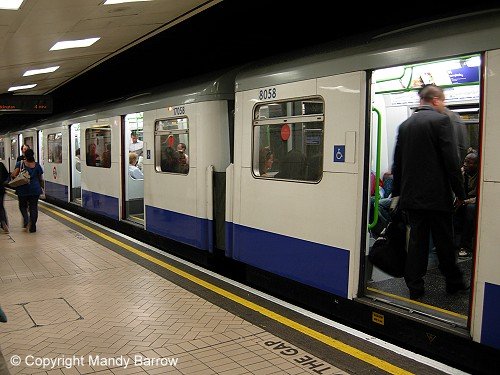
The Northern Line, which runs from High Barnet in the north to Morden in the south, is represented by a black line on the map. The Central line is red, and as its name suggests, it runs from east to west, taking in central London. The Circle line is yellow and is the only line which runs in a complete circle. There are maps at each station as well as inside each train to ensure that you can see where you are going and that you are on the right train. Each stop that you approach will be notified by a loudspeaker in the train. There is another announcement when you arrive at a station. For example: "This is Westminster. This is a District Line train to Upminster" If you find yourself going in the wrong direction, simply get off at the next station and cross the platform to the other side. Every train will have its destination on the front of the train, so it is a good idea to look at the train as it approaches the station.
Top Tip Covent Garden tube station is very popular. There are no escalators. You will have the choice of a lift or the stairs. Do not take the stairs unless you are very fit! I prefer to take the tube to Embankment and do the 10 – 15 minute walk to Covent Garden.
|
|
from the children who live in ther |
 Each line on the underground has a name and is colour coded to make it easier to plan your route.
There is a total of 12 different colored lines in the London Underground system.
Each line on the underground has a name and is colour coded to make it easier to plan your route.
There is a total of 12 different colored lines in the London Underground system. 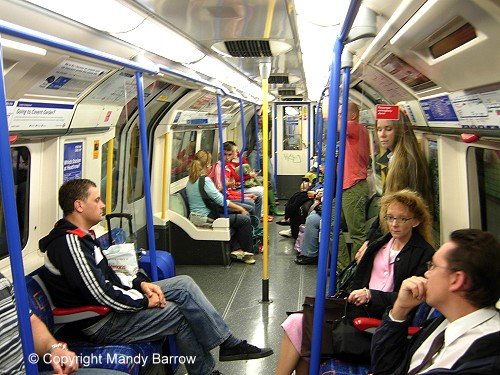
|
 © Copyright – please read © Copyright – please read All the materials on these pages are free for homework and classroom use only. You may not redistribute, sell or place the content of this page on any other website or blog without written permission from the . |
© Copyright 2013
is the creator of the Woodlands Resources section of the Woodlands Junior website.
The two websites projectbritain.com and primaryhomeworkhelp.co.uk are the new homes for the Woodlands Resources.
left Woodlands in 2003 to work in Kent schools as an ICT Consulatant.
She now teaches computers at The Granville School and St. John’s Primary School in Sevenoaks Kent.
Woodlands Junior Homework Help new website